Pilots don't need to be meteorologists. But they need to understand weather well enough to recognize conditions that kill and make smart decisions about whether to fly. Most student pilot weather education covers the textbook concepts; this guide focuses on what you'll actually use every time you preflight.
The atmosphere and why it matters
The standard atmosphere decreases in temperature at approximately 2°C per 1,000 feet (the standard lapse rate). When the actual lapse rate is greater than standard, the atmosphere is unstable — air rises vigorously, building cumulus clouds, turbulence, and potentially thunderstorms. When it's less than standard or inverted (temperature inversion), the atmosphere is stable — smooth air, but also fog, haze, and persistent low ceilings that don't burn off.
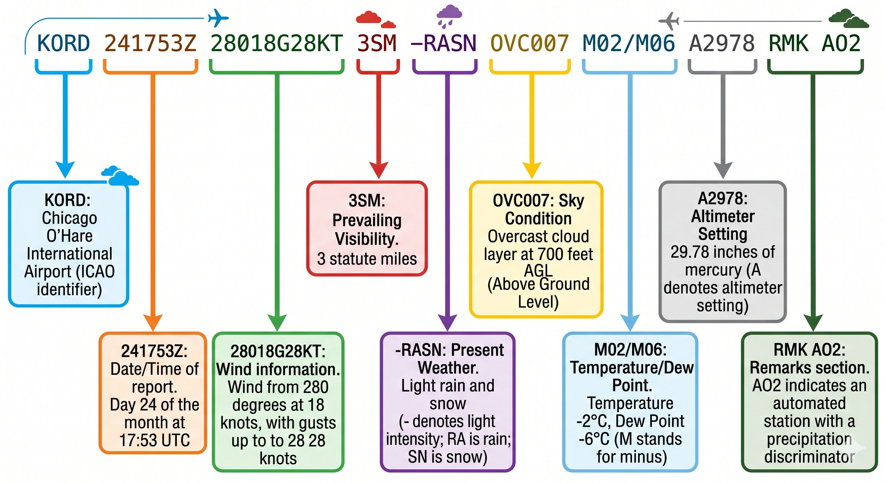
METAR decode — the most common weather product pilots use
Practically: puffy cumulus clouds with vertical development = unstable air = potential for thunderstorms. Flat, layered stratus clouds = stable air = smooth but often IFR conditions. The type of clouds you see tells you a great deal about what's happening above.
64 free PPL ground school videos on YouTube. Also offers a premium interactive course at freepilottraining.net with 700+ practice questions and a written exam endorsement.
Weather systems — fronts and what they bring
Cold fronts
A cold front is the leading edge of a cold air mass pushing under warmer air. Cold fronts typically move faster than warm fronts (25–30 kts vs. 10–15 kts). The weather associated with a cold front is often dramatic: towering cumulus, cumulonimbus, squall lines, and thunderstorms in a narrow band ahead of and along the front, followed by rapid clearing and improved visibility after passage. The "line" of weather can extend hundreds of miles ahead of the surface front.
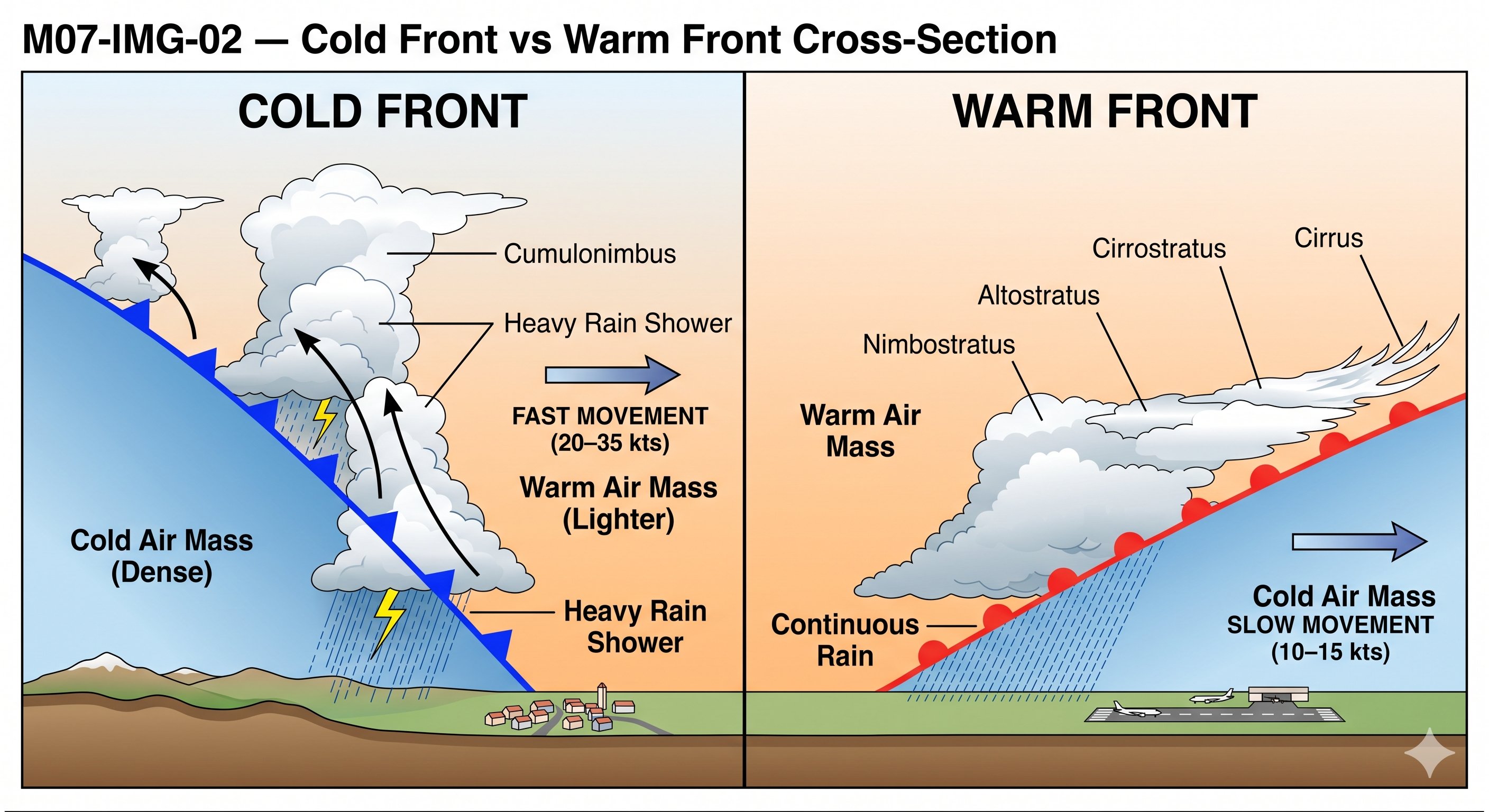
Student pilot lesson: do not fly toward an approaching cold front assuming you'll get through before it arrives. Cold fronts move faster than they appear on synoptic charts.
Warm fronts
A warm front is the leading edge of warm air overriding cold air. Warm fronts move slowly and produce gradual weather deterioration over a large area — sometimes 500–1,000 miles ahead of the surface front. The sequence typically is: cirrus clouds (high and thin), followed by altostratus (middle layer, gray overcast), followed by nimbostratus (low thick overcast with continuous rain or snow). Ceilings lower and visibility decreases steadily for hours before front passage.
Student pilot lesson: warm fronts give more warning time but can trap VFR pilots who start a long flight hoping to outrun deteriorating conditions. The forecast often underestimates how far ahead the low ceilings extend.